


Reality Capture Technologies | Aerial, Terrestrial & LiDAR Solutions
Reality Capture Technologies
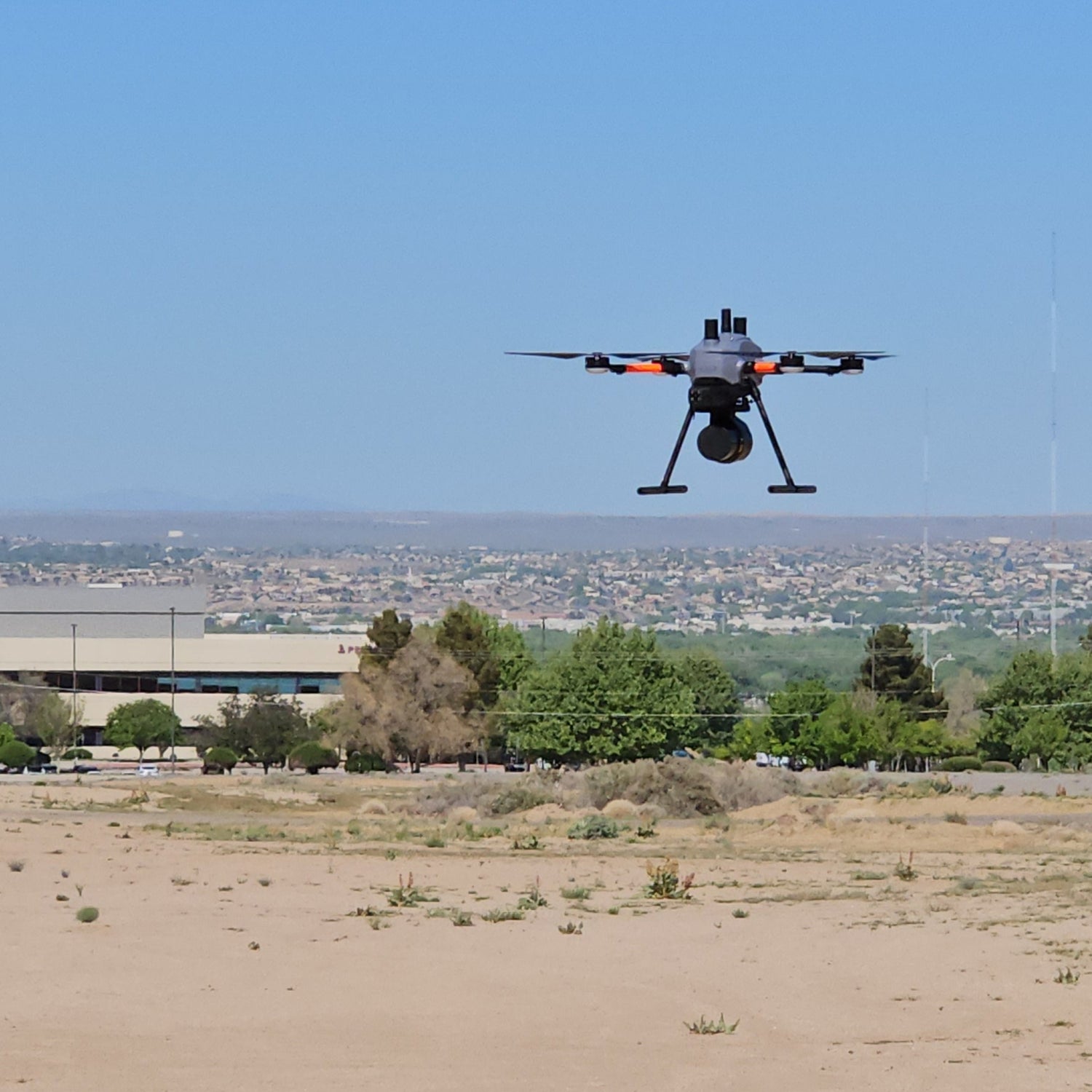
Aerial Systems
Capture high-resolution geospatial data from above with flexible drone and UAV platforms, enabling efficient mapping, surveying, and inspection.
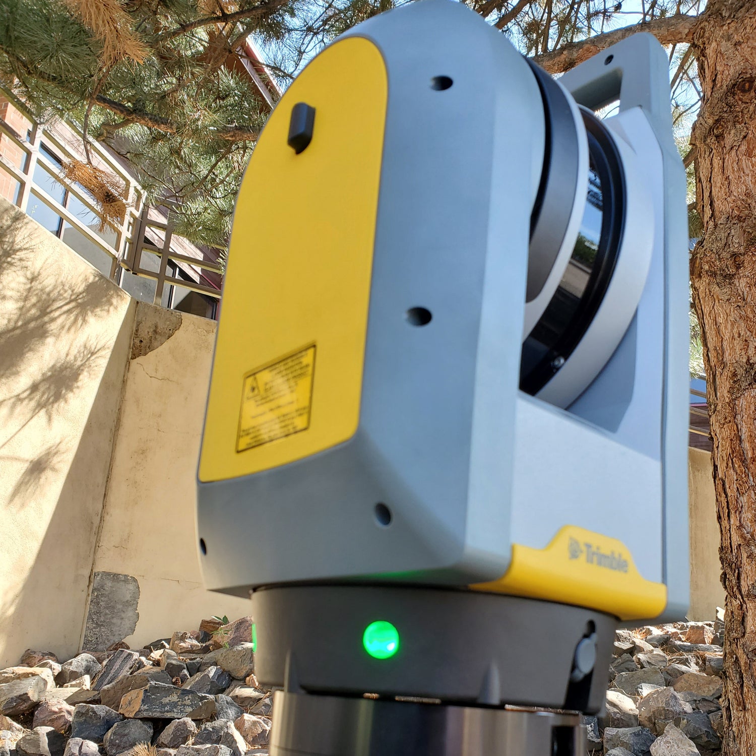
Terrestrial Systems
Utilize ground-based scanners and SLAM (Simultaneous Localization and Mapping) tools to accurately document sites, structures, and environments from the ground level for detailed 3D models.
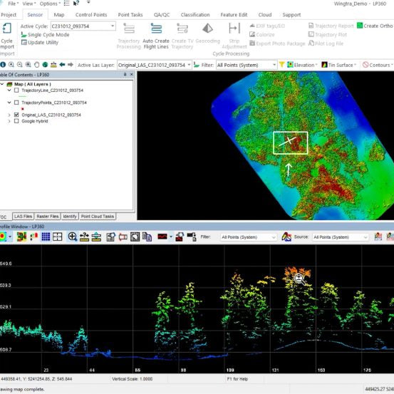
Software and Processing
Transform raw data into action with powerful software for 3D modeling, analysis, visualization, and workflow management.
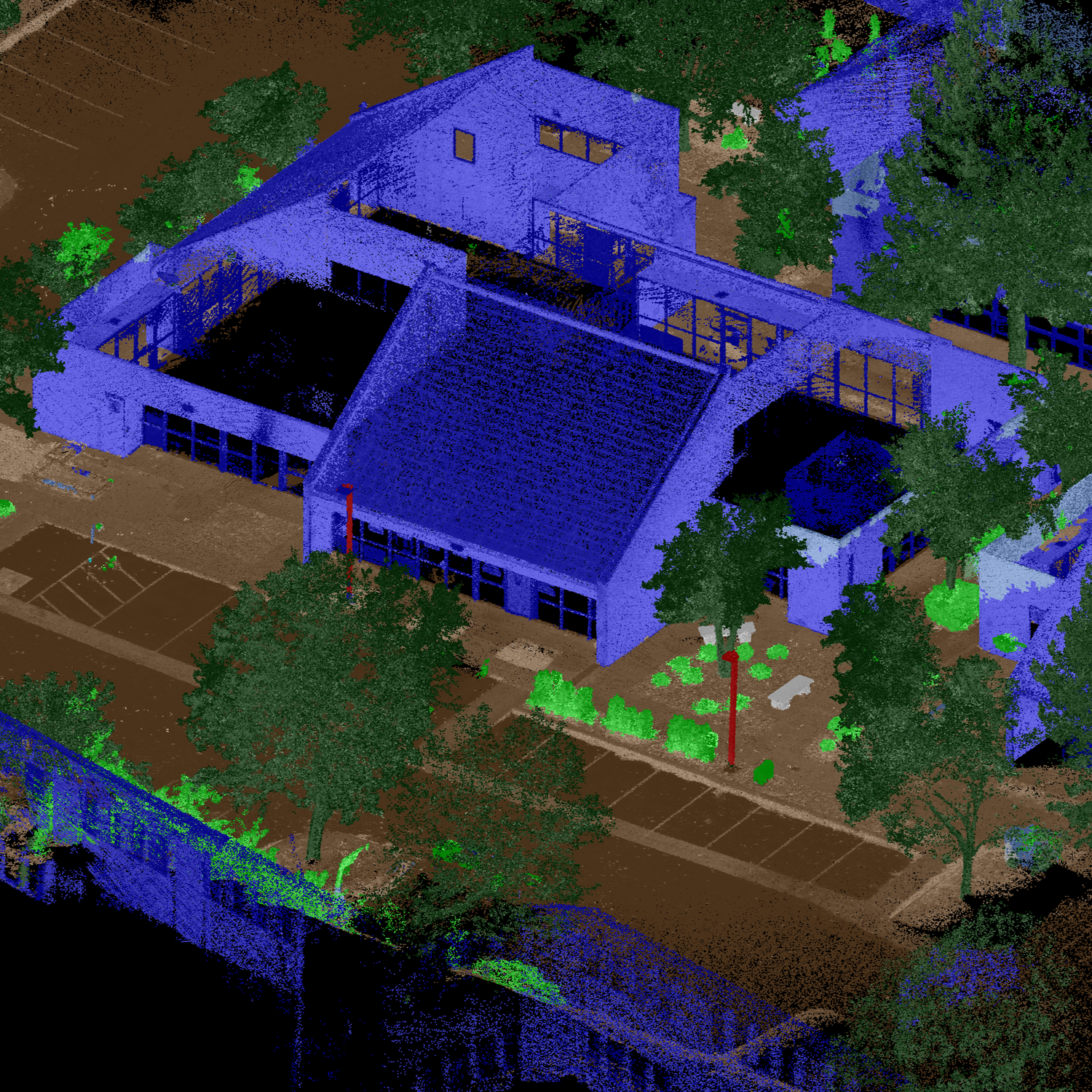
LiDAR Solutions
Harness the precision of LiDAR technology for fast, accurate spatial data collection across a range of projects, from infrastructure to natural environments.