


Vivax-Metrotech: Revolutionizing Survey and Mapping
The survey and mapping industry relies on specialized equipment for accurate data collection.
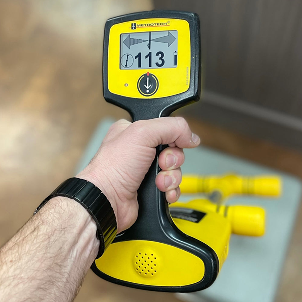
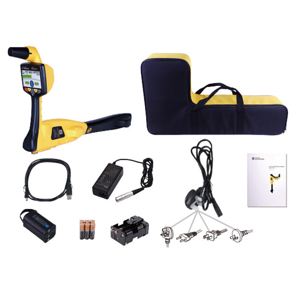
Vivax-Metrotech's Locator range offers features like integrated RTK GNSS, one-hand locating and mapping, cloud-based data management, and survey-grade accuracy, helping reduce the need for excess field equipment.

Real-Time Kinematic GNSS for Centimeter-Level Precision
State-of-the-art RTK GNSS technology delivers fully-integrated, high-precision positioning to within a few centimeters. Rely on survey-grade accuracy for all of your project needs.

Cloud-based Data Management
Seamlessly store and access your project data in the cloud for easy collaboration. Ensure data is safely managed with secure cloud storage.

Simplified Workflow with Fewer Devices
Benefit from consolidated field equipment that streamlines your process. Carry fewer devices without sacrificing performance thanks to simplified locating modes.

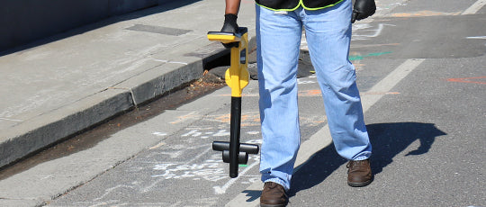
One-Handed Locating and Intuitive Mapping
User-friendly tools enable effortless operation with one hand, facilitating efficient data collection and accurate mapping of locations in the field.
Real-Time Kinematic GNSS for Centimeter-Level Precision
State-of-the-art RTK GNSS technology delivers fully-integrated, high-precision positioning to within a few centimeters. Rely on survey-grade accuracy for all of your project needs.
Cloud-based Data Management
Seamlessly store and access your project data in the cloud for easy collaboration. Ensure data is safely managed with secure cloud storage.


Simplified Workflow with Fewer Devices
Benefit from consolidated field equipment that streamlines your process. Carry fewer devices without sacrificing performance thanks to simplified locating modes.

One-Handed Locating and Intuitive Mapping
User-friendly tools enable effortless operation with one hand, facilitating efficient data collection and accurate mapping of locations in the field.
vLoc3 Receiver Series | Survey-Grade GNSS
vLoc3 utility receivers are vital tools for precise underground utility locating.
Features include 3D antennas, signal distortion detection, RTK GNSS accuracy, digital signal processing, position capturing, and broadband frequency selection. Suitable for utility locating applications like locating buried utilities to prevent damage. Options for data analysis and integration with GIS systems.