-
Shop
- Rent
-
Repair
-
Learn
-
More
Let's talk about it!
Contact Us
Shop
Repair
Learn
More
Let's talk about it!
Contact Us

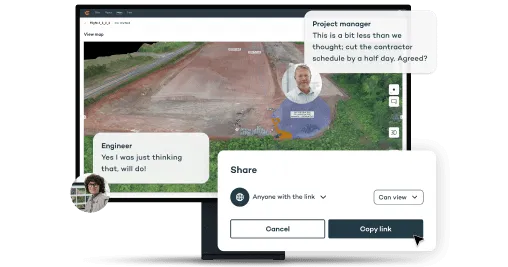
WingtraCLOUD allows your team to confidently scale drone mapping operations by enabling effortless collaboration on survey data from anywhere. From planning and capturing to processing and sharing, everything happens on one intuitive platform—no more juggling multiple tools or outdated files.

Plan - Easily and safely plan even over the most complex terrain.
Capture - Sync up and invite anyone to assess flight plans from anywhere.
Process - Transform images into orthos and point clouds with straightforward geotagging and photogrammetry processing.
Collaborate - Get immediate insights from your maps and share them via hyperlink.
Integrate - Export data to your preferred CAD or GIS software for further analysis.
Want to request a demo, schedule a rental, ask a question, or just share some cool pictures from a job site? We want to hear from you!
And while you are at it, be sure to subscribe to our newsletter.
