


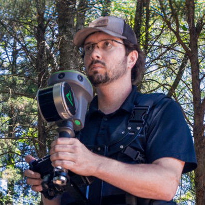
TrueView GO: Handheld SLAM LiDAR for Fast 3D Mapping & Surveying
TrueView GO
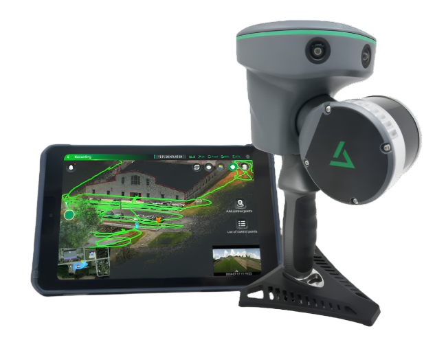
TrueView GO is a cutting-edge mobile mapping system that leverages SLAM (Simultaneous Localization and Mapping) technology to deliver real-time 3D point clouds. Designed for versatility and ease-of-use, TrueView GO is perfect for rapidly collecting high-quality spatial data in a wide range of environments—indoors or outdoors, even where GNSS is unavailable.
Vectors put the TrueView GO handheld LiDAR and SLAM scanner to the test!
Key Features & Benefits

SLAM Technology
Capture accurate 3D spatial data without the need for GPS—enabling mapping in GNSS-challenged environments such as tunnels, forests, and building interiors.
Real-Time Processing
Quickly generate detailed 3D point clouds on-site, speeding up workflows and project delivery.

Flexible Mounting Options
Use as a handheld device, backpack system, or mount on vehicles and drones for maximum coverage.

Lightweight & Portable
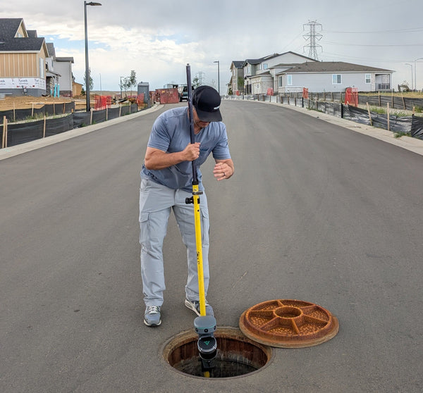
Weighing in at around 4 lbs, TrueView Go is easy to transport and operate, making it ideal for one-person field teams.

Intuitive Workflow
Simple setup, user-friendly interface, and efficient data export integrate easily into your existing geospatial processes.
Wide Range of Applications
Ideal for surveying, construction, facility management, forestry, mining, urban mapping, and more.
SLAM Technology
Capture accurate 3D spatial data without the need for GPS—enabling mapping in GNSS-challenged environments such as tunnels, forests, and building interiors.
Real-Time Processing
Quickly generate detailed 3D point clouds on-site, speeding up workflows and project delivery.
Flexible Mounting Options
Use as a handheld device, backpack system, or mount on vehicles and drones for maximum coverage.

Lightweight & Portable
Weighing in at around 4 lbs, TrueView Go is easy to transport and operate, making it ideal for one-person field teams.

Intuitive Workflow
Simple setup, user-friendly interface, and efficient data export integrate easily into your existing geospatial processes.
Wide Range of Applications
Ideal for surveying, construction, facility management, forestry, mining, urban mapping, and more.
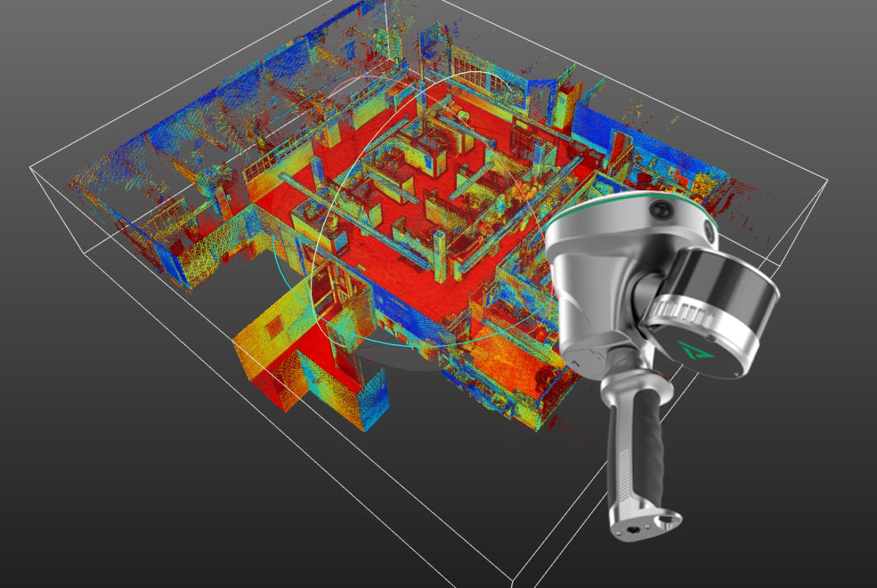
How Does it Work?
TrueView Go employs LiDAR sensors combined with advanced SLAM algorithms to scan and model environments as you move through them. As the system gathers spatial data, it continuously maps your trajectory and surroundings, delivering accurate 3D representations—all without relying on a stable GPS signal.
Equipped with either 16 or 32 channels,
three high-resolution 5MP RGB cameras, and an advanced 3D LiDAR & Imagery scanner, this device transforms complex environments into accurate digital
twins with the ease of a stroll.